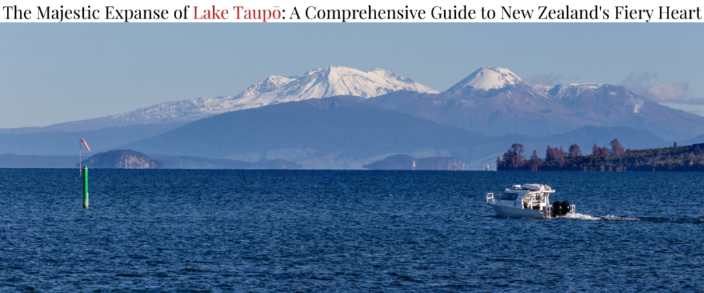
Situated in the geographical centre of New Zealand’s North Island, Lake Taupō is a breathtaking expanse of deep, clear water that acts as the ecological and cultural crown jewel of the Waikato region. Covering a surface area of approximately 616 square kilometres and reaching maximum depths of 165 metres, it holds the distinction of being the largest freshwater lake in Australasia1. However, beneath this serene and picturesque surface lies an exceptionally violent and dynamic geological history. Lake Taupō is not merely a topographical basin filled with water; it is the flooded caldera of one of the world’s most active, productive, and dangerous rhyolitic supervolcanoes4.
The lake represents a profound intersection of immense natural forces and human endeavour. From its catastrophic geological origins and profound significance in Māori mythology to its modern role as a hub for international tourism, an engine for national hydroelectric power generation, and a global model for pioneering environmental conservation, Lake Taupō is a landscape defined by delicate balances and extremes. This comprehensive report explores the multifaceted nature of Lake Taupō, providing a deep dive into its tectonic framework, cultural heritage, ecological dynamics, and modern economic footprint.
Tectonic Framework and the Taupō Volcanic Zone
To fully comprehend the existence and behaviour of Lake Taupō, one must first examine the broader tectonic environment of the Pacific Ring of Fire. The lake is situated centrally within the Taupō Volcanic Zone (TVZ), a highly active rifted volcanic arc extending roughly 350 kilometres from Mount Ruapehu in the southwest to Whakaari (White Island) offshore in the Bay of Plenty6.
Rift Kinematics and Crustal Architecture
The geological engine driving the TVZ is the oblique subduction of the Pacific Plate beneath the Australian Plate along the Hikurangi Trench, off the east coast of the North Island8. However, the TVZ diverges from traditional volcanic arc models; it is characterised by intra-arc continental rifting7. The region is effectively being pulled apart, widening unevenly from east to west. The extension rates vary significantly along the rift, registering near zero at the southern termination near Whanganui, roughly 8 millimetres per year at Taupō, and accelerating up to 15 millimetres per year near the Bay of Plenty coastline and the offshore Whakatane Graben7.
This intense and continuous extensional force has severely thinned the Earth’s crust beneath the lake. Seismic imaging and geodetic studies indicate that the quartzo-feldspathic continental crust beneath the central TVZ is exceptionally thin, measuring as little as 15 to 16 kilometres in depth4. Beneath this fragile, brittle crust lies a massive accumulation of partial melt. Studies show that a vast body of magma, spanning 50 kilometres in width and 160 kilometres in length, heavily intruded by mafic basalts from the mantle, resides at depths between 6 and 10 kilometres4.
The extreme heat flux generated by this mantle upwelling melts the overlying continental crust, producing highly viscous, silica-rich rhyolitic magma4. The central segment of the TVZ, which houses the Taupō and Okataina calderas, is globally unparalleled, recognised as the most active and productive region of silicic volcanism on Earth during the Quaternary period6.
Transition from the Coromandel Volcanic Zone
The current activity of the TVZ represents a southward migration of volcanism over millions of years. Andesitic activity in the broader region began around 18 to 23 million years ago in the Northland and Coromandel Volcanic Zone (CVZ)6. Rhyolitic volcanism in the CVZ commenced roughly 10 million years ago10.
As the tectonic stresses shifted, the primary locus of volcanism migrated southward into the modern TVZ approximately 2 million years ago10. The history of the TVZ is generally divided into the ‘old TVZ’ (2.0 Ma to 0.34 Ma) and the ‘young TVZ’ (0.34 Ma onwards)11. This transition is marked by voluminous ignimbrite flare-ups, such as those that formed the Mangakino caldera (1.62–0.91 Ma) and the transitional Waiteariki Ignimbrite, leading eventually to the establishment of the highly productive modern caldera systems10.
Geological Evolution: Calderas and Cataclysms
Taupō Volcano has been active for approximately 300,000 years, but its modern landscape and the shape of the caldera that holds the lake were largely defined by two cataclysmic events: the Oruanui eruption and the Hatepe eruption4. Within the last 1.6 million years, the central TVZ has hosted at least 26 known caldera-forming eruptions, but the events originating from Taupō stand out for their extreme magnitude and destructive power9.
The Oruanui Eruption (25,500 Years Ago)
Occurring approximately 25,500 years ago, the Oruanui eruption (also known as the Kawakawa event) is the largest known volcanic event on Earth in the past 70,000 years4. It is classified as a magnitude 8 on the Volcanic Explosivity Index (VEI)—the highest possible rating for a volcanic eruption4.
The scale of the Oruanui event was apocalyptic, expelling an estimated 530 cubic kilometres of rhyolitic magma4. The structural collapse of the subterranean magma chamber caused the overlying ground to sink by kilometres, creating a massive caldera that would eventually fill with water to become Lake Taupō13.
| Volcanic Deposit Type | Estimated Volume | Environmental Impact |
| Pyroclastic Fall (Ash/Pumice) | 430 km³ | Plinian eruption columns injected material into the stratosphere. Ash blanketed the North Island and reached the Chatham Islands. |
| Pyroclastic Density Currents | 320 km³ | Superheated avalanches of gas and rock swept across the landscape, depositing thick layers of ignimbrite up to 200 metres deep. |
| Primary Intracaldera Material | 420 km³ | Material that collapsed directly back into the newly formed caldera basin during the eruption. |
Table 1: Distribution of volcanic material from the Oruanui Eruption4.
The ashfall was historically profound. Geological records indicate that areas such as modern-day Napier were buried under two metres of ash, Gisborne under 1.2 metres, and regions as far away as Wellington saw deposits of 20 centimetres13. The Oruanui eruption dramatically altered the global climate and permanently reshaped the geography of the central North Island, destroying much of the evidence of the volcano’s previous 270,000 years of activity1.
The Hatepe Eruption (c. 232 CE)
While the Oruanui event excavated the lake’s basin, a much more recent eruption dramatically reshaped the immediate surrounding topography. Occurring around 1,800 years ago (radiocarbon dated and wiggle-matched to approximately 232 CE ± 10 years), the Hatepe eruption—also known as the Taupō eruption or Horomatangi Reef Unit Y eruption—was the most violent volcanic event on Earth in the last 5,000 years4.
Though its total magma volume was significantly smaller than Oruanui (about 35 cubic kilometres of magma), the Hatepe eruption is renowned for generating one of the most extreme volcanic hazards ever recorded: a highly mobile and devastatingly energetic pyroclastic flow4.
The eruption began with a series of complex phases. Initially, a minor eruption beneath the ancestral lake produced fine ash4. This was followed by a dramatic increase in activity from a second vent, producing a high Plinian eruption column and dry ash. Subsequently, a vent erupted massive volumes of wet phreatoplinian ash (caused by water from the lake interacting directly with the rising magma)4.
The climax of the eruption occurred when part of the vent area collapsed, unleashing approximately 30 cubic kilometres of material into a pyroclastic density current that blasted outward at speeds between 600 and 900 kilometres per hour4. This superheated flow radiated outward, devastating an area of 20,000 square kilometres (a radius of approximately 80 kilometres) in less than 15 minutes4.
The flow possessed such immense kinetic energy that it climbed over 1,500 metres to overtop the nearby Kaimanawa Ranges and Mount Tongariro, leaving ignimbrite deposits stretching from Rotorua to Waiouru4. Only the massive bulk of Mount Ruapehu was high enough to divert the flow4. It scoured the ground surface, filled deep river valleys with ignimbrite to even out the landscape, and flattened all vegetation instantly4. The energy released is estimated to have been equivalent to 150 ± 50 megatons of TNT4. Global historical and paleoclimatic records point to severe atmospheric impacts from the eruption; ice cores from both hemispheres, alongside ancient Roman and Chinese Han dynasty records of red skies, have been analysed by researchers attempting to pinpoint the precise climatic effects of global mid-Holocene eruptions4. Today, the rounded pumice found on North Island beaches and the flat, evened-out valleys of the central North Island are direct geological legacies of this catastrophic surge5.
Modern Volcanic Unrest and Geohazards
Despite a period of eruptive quiescence over the last 1,800 years, the Taupō supervolcano is highly active. The geological record reveals that the magmatic system resets rapidly; there were 28 smaller explosive eruptions between the Oruanui and Hatepe events13.
In modern times, Taupō expresses its volatility through periods of heightened seismicity and ground deformation. Since 1872, there have been at least 16 documented episodes of volcanic unrest2.
The 2022-2023 Seismic Swarm and Deformation
The most recent and intense monitored unrest episode occurred between May 2022 and May 202319. Ending a period of relative quiescence following a previous moderate unrest event in 2019, the GeoNet monitoring system detected a significant escalation in seismic activity directly beneath the lake2. Over the 13-month period, more than 1,780 volcano-tectonic earthquakes were recorded19.
This sustained activity prompted GNS Science to raise the Volcanic Alert Level for Taupō to Level 1 (minor volcanic unrest) in September 2022—the first time the alert level had been formally raised under the modern system19. The unrest culminated on November 30, 2022, with a magnitude 5.7 earthquake originating at a depth of 9 kilometres beneath the lake19.
The event was accompanied by severe ground deformation. GPS instruments anchored to the Horomatangi Reefs (a shallow underwater plateau representing rhyolitic lava domes extruded shortly after the Hatepe eruption) recorded 180 millimetres (18 centimetres) of upward vertical lift and 25 centimetres of horizontal shift to the southeast—the largest ever recorded ground movement at this location19. The sudden displacement of the lakebed generated a complex lake tsunami (seiche) of approximately 0.2 metres and triggered a submarine landslide near Wharewaka Point, causing localised wave run-up and flooding on the foreshore19.
By May 2023, earthquake activity and ground deformation declined, and the Volcanic Alert Level was returned to zero2. Moment tensor inversions and geodetic modelling suggest that the seismic unrest was caused by the reactivation of existing caldera faults, driven by an intrusion of magma at depth and the mobilisation of hydrothermal fluids19.
Lake Microseisms and Non-Harmonic Tremors
Monitoring a volcano situated beneath a massive body of water presents unique seismological challenges. During the 2019 unrest period, seismologists observed low-frequency (0.50–1.0 Hz) signals resembling non-harmonic volcanic tremor—a phenomenon usually indicative of magmatic fluid mobilization2.
However, careful time-frequency analysis and correlation with local weather data revealed that these signals were not magmatic. Instead, they were lake microseisms caused by wind-driven waves2. The interaction of wind, bathymetry, shoreline characteristics, and the lake’s fetch created seismic noise that perfectly mimicked volcanic tremors2. This discovery highlighted the complexities of volcano-seismic monitoring in aquatic environments, emphasising the need to filter out environmental noise to accurately forecast eruptions2.
Geothermal Extraction and Land Subsidence
The immense heat flux driving the Taupō Volcanic Zone provides significant opportunities for geothermal energy generation. However, the extraction of these subterranean fluids is closely linked to major geomechanical consequences, most notably land subsidence.
The Wairakei Phenomenon
Located just north of Lake Taupō, the Wairakei geothermal field was one of the first liquid-dominated hydrothermal systems in the world to be heavily exploited for power production, beginning in the late 1950s25. The extraction of vast quantities of hot water and steam from the reservoir, initially with very little reinjection, led to severe pressure declines within the deep aquifers26.
This depressurisation triggered the compaction of the highly porous (30% to 60%) and compressible Huka Falls Formation—a sedimentary sequence of mudstones and siltstones acting as a capping layer over the geothermal reservoir29. The resulting compaction manifested at the surface as dramatic ground subsidence.
The subsidence at Wairakei is recognised globally for its severity, with maximum vertical displacement rates reaching up to 450 millimetres per year, resulting in total subsidence exceeding 15 metres since monitoring began28. This deformation caused extreme horizontal ground strains, forcing significant engineering adaptations to accommodate stretching and compression in steam pipelines, drainage canals, and highway infrastructure26. While deep fluid reinjection practices (increasing since 2006) have stabilised pressure declines, they introduce separate challenges, such as triggering moderate levels of localised microseismicity along inferred fault zones27. The Wairakei experience serves as a critical baseline for understanding the geomechanical fragility of the TVZ crust under anthropogenic stress28.
Māori Heritage and Cultural Geography
Long before European arrival, the indigenous Māori people navigated the central North Island, forging a deep spiritual and physical connection with Lake Taupō. The region is the ancestral homeland of the Ngāti Tūwharetoa iwi (tribe), who hold mana whenua (territorial rights) and act as kaitiaki (guardians) of the lake31.
The Arrival of Te Arawa and the Naming of Taupō-nui-a-Tia
The name “Taupō” is an abbreviation of its full traditional name: Taupō-nui-a-Tia, which translates to “The great cloak of Tia”25. According to Māori oral tradition, the naming originates from the early Polynesian explorers who arrived on the Te Arawa waka (canoe) from Hawaiki, the mythical homeland, with regional settlement dating back approximately 700 years25.
Tia, a rangatira (chief) and explorer, journeyed inland to the central plateau. Upon arriving at the eastern shores of the great lake near modern-day Pākā Bay, he noticed a striking cliff formation. The varying colours of the rock—red, yellow, white, and black—closely resembled the woven tāniko border of his heavy rain cloak25. Claiming the territory, he set up a tūāhu (altar) and named the place Taupō-nui-a-Tia31.
Simultaneously, Ngātoro-i-rangi, the great navigator and tohunga (high priest) of the Te Arawa canoe, was also exploring the region. Ngātoro-i-rangi arrived at the same eastern shore at dusk31. A dispute over ownership ensued, with Ngātoro-i-rangi claiming his altar was older, a claim allegedly backed by the assertion that “Taupō” also derived from tau (to settle or rest) and po (night)31. Through his immense mana (spiritual power and prestige), Ngātoro-i-rangi forced Tia to concede. Tia moved westward toward Mount Titiraupenga, and Ngātoro-i-rangi claimed the lake for his descendants, who would eventually form the Ngāti Tūwharetoa under the lineage of the 16th-century warrior chief Tūwharetoa31.
Mythological Origins and the Realm of Rūaumoko
While geology attributes the lake to caldera collapse, Māori mythology offers a rich, anthropomorphic narrative rooted in the actions of ancestors and gods. In one legend, Ngātoro-i-rangi climbed to the summit of Mount Tauhara and looked down upon a vast, barren dust bowl31. Wishing to bring life and water to the desolate land, he uprooted a giant tōtara tree from the mountain and hurled it into the basin. A fierce west wind altered the tree’s trajectory, causing it to land upside down. Its massive branches pierced the earth, allowing fresh subterranean springs to well up, thereby creating Taupō moana (the sea of Taupō)31.
The surrounding geothermal features also owe their existence to Ngātoro-i-rangi. While exploring the freezing alpine environments of the central plateau near Mount Tongariro, he was overcome by extreme cold and faced death32. He called out to his sisters, Kuiwai and Haungaroa, who were far away in Hawaiki35. Hearing his desperate pleas, they sent fire beneath the earth. The fire burst through the ground at various intervals as it travelled to him, creating the geysers, hot mud pools, and thermal vents that pepper the Taupō Volcanic Zone today, effectively opening the realm of Rūaumoko (the god of volcanoes and earthquakes)13.
Motutaiko Island and the Taniwha Horomatangi
Rising 452 metres above sea level (approximately 90 metres above the lake surface) is Motutaiko Island, the only island within Lake Taupō37. Formed by a column of rhyolitic lava that extruded from an underwater vent following the Hatepe eruption, the island is of immense ecological and spiritual significance37. Ecologically, it is a sanctuary for endangered species, including the Wainuia clarki snail and small-scaled skinks37.
Culturally, Motutaiko is highly tapu (sacred). In the 17th and 18th centuries, it served as a stronghold for major Ngāti Tūwharetoa chiefs like Tamamutu and his great-grandson Rangituamātotoru39. Rangituamātotoru was later buried in a sacred cave on the island37. Due to its status as an urupā (burial ground), landing on the island is strictly prohibited by both customary law and government regulation37.
The waters surrounding Motutaiko are guarded by Horomatangi, a fearsome taniwha (supernatural water creature) brought from Hawaiki by Ngātoro-i-rangi36. Legends describe Horomatangi as a beast with extraordinary mana that resides in an underwater cave on the northeastern face of the island, near the Horomatangi Reefs37. Often appearing as a giant reptile, a black rock, or an old man red as fire, Horomatangi is known to lash the lake into violent storms and overturn the waka (canoes) of those who lack the mana to appease him, or those who show disrespect to his domain36.
Horomatangi was often accompanied by a decoy familiar named Atiamuri. Taking the form of a man in a canoe at dusk, Atiamuri would paddle near shoreline settlements, drawing the curiosity of villagers, only to vanish into the mist, luring unsuspecting boats out into the deeper waters where Horomatangi waited40. The power attributed to Horomatangi is such that even the devastating 1845 landslide at Te Rapa, which tragically killed the great paramount chief Te Heuheu Tukino and his people, was attributed to the wrath of the taniwha overcoming the chief’s mana36.
Modern Cultural Expressions: Mine Bay Carvings
A modern addition to the cultural landscape of Lake Taupō is the magnificent Mine Bay Māori Rock Carvings. Accessible only by boat, these towering carvings reach 14 metres in height on a cliff face overlooking the water41. Sculpted in the late 1970s and completed in 1980 by master carver Matahi Whakataka-Brightwell and his team, the primary carving depicts Ngātoro-i-rangi, serving as a permanent, monumental homage to the navigator who guided the Tūwharetoa people to the region41.
Limnology and Ecological Dynamics
Beyond its volcanic and cultural significance, Lake Taupō is a highly complex aquatic ecosystem. Its sheer size and depth create specific physical and chemical dynamics that govern the life within it, heavily influenced by its classification as an oligotrophic (low nutrient, high clarity) deep lake.
Thermal Stratification and Mixing Regimes
Lake Taupō is classified as a warm monomictic lake, meaning its waters remain thermally stratified for most of the year but undergo a single, complete mixing event (overturn) during the winter3.
The physics of this stratification relies on the unique density properties of water, which is at its densest at 4°C44. As the Southern Hemisphere transitions into spring and summer, solar radiation rapidly warms the surface waters of Lake Taupō. Because this warm water is less dense, it floats on top of the cooler, denser water below44. This creates a highly stable, three-tiered thermal stratification43:
- The Epilimnion: The warm, wind-mixed upper layer that interacts with the atmosphere and contains the highest concentrations of dissolved oxygen.
- The Metalimnion (Thermocline): The transition zone where temperature and density change rapidly with depth, acting as a physical barrier preventing the mixing of the upper and lower layers.
- The Hypolimnion: The deep, cold bottom layer of the lake, almost completely cut off from atmospheric oxygen exchange during the summer months.
Once stratified, the hypolimnion becomes isolated. Biological processes within this deep layer, primarily the decomposition of settling organic matter (like dead algae), slowly consume dissolved oxygen43. In highly productive (eutrophic) lakes, this can lead to severe anoxia, stressing aquatic life. Because Lake Taupō is oligotrophic, the oxygen depletion is gradual, but it still represents a critical seasonal dynamic47.
As autumn turns to winter, the surface waters cool. Once the temperature of the epilimnion cools to match the density of the hypolimnion, the thermal barrier collapses44. Aided by winter winds, the entire water column mixes completely—the annual overturn44. This critical process redistributes oxygen down to the lake bed and brings accumulated nutrients (like dissolved phosphorus and nitrogen) back to the surface, sparking the biological productivity required for the spring45. Recent climate change studies utilising 3D hydrodynamic models suggest that warming air temperatures are increasing the duration and stability of this stratification, subtly altering dissolved oxygen concentrations in the lake’s bottom waters47.
Water Clarity, Nutrients, and Phytoplankton
Lake Taupō is globally renowned for its exceptional water clarity, typically measured using a Secchi disc. Deep oligotrophic lakes usually feature high visual clarity due to naturally low concentrations of phytoplankton3. In Taupō, clarity fluctuates seasonally, often reaching its maximum in late summer (e.g., up to 16.5 metres recorded in March 2017) when surface nutrients are depleted, and dropping to its minimum during the winter overturn (around 10 metres) when deep-water nutrients are brought to the surface, sparking algal growth49.
The lake’s primary producers follow a seasonal succession. During the winter, the phytoplankton community is dominated by diatoms (such as Aulacoseira granulata and Synedra sp.)50. During the summer, dinoflagellates (Ceratium sp.) and diatoms (Fragilaria crotonensis) dominate50. Cyanobacteria (blue-green algae), predominantly Dolichospermum lemmermannii, are generally present but make up only about 1% of the biovolume, peaking slightly in late autumn50.
Interestingly, Lake Taupō features a prominent “deep chlorophyll maximum”—a dense layer of phytoplankton residing around 50 metres deep3. At this depth, organisms balance the availability of upwelling nutrients from the hypolimnion with just enough penetrating sunlight to photosynthesise effectively, demonstrating the intricate coupling between nutrient cycling and food web dynamics3.
The Fishery: Ecological Shift and Management
Lake Taupō is an internationally acclaimed destination for recreational fishing, though this ecosystem is highly altered from its pre-European state. Before the late 19th century, the lake’s food web was dominated by native species, primarily the kōaro (a native galaxiid) and the kākahi (freshwater mussel)51.
Introduction of Exotic Species
In the late 1890s and early 1900s, European settlers, seeking to establish a sports fishery, introduced brown trout (Salmo trutta) and rainbow trout (Oncorhynchus mykiss) into the lake and surrounding rivers25. The introductions, heavily advocated by early fishing enthusiasts like Reverend Henry Fletcher and supported by the Auckland Acclimatisation Society, were massively successful from a sporting perspective but ecologically devastating52. The predatory trout rapidly decimated the native kōaro populations51.
Realising the trout were depleting their own food supply, managers introduced common smelt (Retropinna retropinna) as a forage fish54. Today, smelt are the keystone planktivore in the lake, comprising approximately 98% of the trout diet by biomass, effectively underpinning the entire modern fishery54.
Population Dynamics and Fishery Management
The management of the Taupō trout fishery, overseen by the Department of Conservation (DOC), is unique because it relies entirely on a wild, self-sustaining population52. Despite frequent calls from some anglers to utilise hatchery stocking during low-catch years, DOC has firmly maintained that the fishery is wild56. Trout migrate up tributaries like the Tongariro River to spawn naturally between March and November52.
The health of the fishery is heavily monitored using a combination of techniques. Acoustic echo-sounding surveys are used to estimate the total population (e.g., historical surveys identifying 110,000 legal-sized fish and 230,000 undersized fish), while fish traps weigh, measure, and fin-clip spawning runs55.
Catch per unit effort (CPUE) is also a critical metric. Using mathematical models (such as CPUE = qN^1/o), managers estimate fish abundance based on angler success rates, though this is heavily influenced by factors like river flow, weather, and angler skill55. Over the decades, as angler numbers peaked (reaching over 82,000 season licenses in the late 1980s), bag limits have been aggressively adjusted to prevent overharvesting, dropping from 25 fish per day in 1926 to modern limits of just 6 fish per day53.
Environmental Stewardship: The Nitrogen Cap-and-Trade Market
In the late 1990s, extensive limnological monitoring by Environment Waikato (now Waikato Regional Council) revealed a troubling trend: the pristine water quality of Lake Taupō was slowly degrading58. The cause was identified as a steady, insidious increase in nitrogen leaching into the lake through groundwater and surface tributaries58.
The Threat of Eutrophication
Nitrogen is a limiting nutrient in most aquatic systems. When excessive amounts enter an oligotrophic lake like Taupō, it overstimulates the growth of phytoplankton and nuisance algae, leading to reduced water clarity, toxic algal blooms, and oxygen depletion47. Scientific studies indicated that the total nitrogen load entering Lake Taupō was approximately 1,360 tonnes annually58.
While roughly 60% of this was from unmanageable natural sources (such as atmospheric deposition and runoff from undeveloped land), about 556 tonnes were human-induced58. The vast majority of this manageable load (over 90%) was traced directly to pastoral farming—specifically sheep, beef, and dairy operations61. These operations had intensified in the catchment following the mid-20th-century resolution of cobalt soil deficiencies (known locally as “bush sickness”), which previously prevented intensive agriculture25. Because groundwater in the Taupō volcanic aquifer moves extremely slowly, nitrogen applied to pastoral fields decades earlier was only just beginning to enter the lake in the early 2000s, meaning the problem was guaranteed to worsen without intervention58.
Policy Innovation and Market Implementation
Faced with the threat of irreversible eutrophication and the potential collapse of a vital tourism and ecological asset, local and national authorities enacted a globally unprecedented policy response. In 2007, the Lake Taupō Protection Trust was established, backed by an $81.5 million public fund contributed by the Ministry for the Environment (45%), Waikato Regional Council (33%), and Taupō District Council (22%)59.
The Trust’s mandate was explicitly clear: permanently reduce the manageable nitrogen leaching into the lake by 20%, which equated to a reduction of 170 tonnes (170,300 kg) per year, by the year 202058.
To achieve this, the regional government introduced Variation 5 to the regional plan, placing a strict environmental cap on the entire catchment61. Using the OVERSEER nutrient budgeting model, every farm in the catchment was benchmarked based on its highest nitrogen leaching year between 2001 and 2005. Each farm was then allocated a Nitrogen Discharge Allowance (NDA), establishing a formal “grandparenting” property right to discharge non-point source nitrogen61.
With the cap in place, the Trust operated within a newly formed nitrogen trading market—the only trading programme globally where diffuse sources of pollution operate under a strict cap58. Using the public fund, the Trust purchased NDAs directly from farmers. In many cases, the Trust bought entire farms, stripped them of their high-leaching nitrogen allowances, and on-sold them with covenants requiring low-nitrogen land uses62. This provided the financial capital for landowners to transition their properties from high-leaching pastoral agriculture into low-leaching plantation forestry or other sustainable ventures (like dairy sheep or olives)58.
The cap-and-trade system was a resounding success. By converting between 5,800 and 7,000 hectares of pastoral land into forestry, the Trust met its 170-tonne reduction target in 2015—four years ahead of schedule and under budget62. Acknowledged by the OECD as a pioneering triumph in environmental policy, the Lake Taupō project proved that market mechanisms, when backed by robust scientific modelling and public funding, can effectively manage diffuse agricultural pollution58. Today, strict compliance monitoring ensures the 999-year perpetuity contracts remain enforced, safeguarding the lake’s clarity65.
Hydroelectric Infrastructure: The Tongariro Power Scheme
Lake Taupō is not only a natural wonder but also a critical engineered component of New Zealand’s energy infrastructure. Its vast waters function as a massive storage reservoir that feeds a succession of nine hydroelectric power stations cascading down the Waikato River to the sea25. To maximise this generation capacity and capture water that would naturally flow away from the lake, the New Zealand government undertook one of the most ambitious engineering projects in the country’s history: the Tongariro Power Scheme.
Engineering the Catchment
Constructed between 1964 and 1983 by the Ministry of Works (with major tunnelling contracts executed by Italian firms Codelfa-Cogefar), the scheme was designed to capture water from 36 rivers and streams across a massive 2,600-square-kilometre catchment69. This catchment encompasses the high-precipitation alpine areas of Mount Ruapehu, Mount Tongariro, Mount Ngauruhoe, and the western Kaimanawa Ranges69. By intercepting these waters before they flowed into the Tasman Sea (via the Whanganui River) or the Pacific Ocean (via the Whangaehu and Rangitīkei Rivers), the scheme diverts them through a sprawling, 80-kilometre network of tunnels, canals, and artificial lakes directly into Lake Taupō69.
Operational Mechanics and Diversions
The scheme is divided into massive, distinct diversion projects:
- The Eastern Diversion: This sector intercepts water from 22 tributaries feeding the Whangaehu River. Crucially, it actively avoids taking water from the main Whangaehu River itself, as that river drains directly from Mount Ruapehu’s highly acidic crater lake, which would destroy the turbines69. The pristine tributary water is channelled through the 8.4-kilometre Wahianoa Aqueduct, buried beneath the acidic river, and then funnelled through the 19.2-kilometre Moawhango Tunnel into the Rangipō Dam on the Tongariro River69.
- The Western Diversion: This sector diverts water from the Whakapapa and Whanganui rivers through a 16.5-kilometre tunnel into Lake Te Whaiau and Lake Otamangakau, before routing it via the Wairehu Canal to join the Eastern waters in Lake Rotoaira69.
The combined diverted water powers three distinct hydroelectric stations before finally discharging into Lake Taupō69:
| Power Station | Commission Year | Capacity (MW) | Facility Type |
| Tokaanu | 1973 | 240 | Surface |
| Rangipō | 1983 | 120 | Underground (63m depth) |
| Mangaio | 2008 | 1.8 | Mini-hydro |
Table 2: Power stations comprising the Tongariro Power Scheme71.
Together, these stations generate approximately 1,350 gigawatt-hours (GWh) of electricity annually, contributing around 4% of New Zealand’s total electricity generation69. While the scheme was highly controversial during its inception in the 1950s and 60s—failing to adequately consult Ngāti Tūwharetoa and ignoring early protests from local fishing communities regarding the alteration of natural waterways—it now operates under stringent environmental resource consents70. Operated today by Genesis Energy, the scheme balances national energy demands with ecological minimum flow requirements, recreational water releases, and aesthetic considerations for the Tongariro National Park69.
Tourism Economy and Future Outlook
The confluence of pristine water, spectacular volcanic landscapes, engineered recreational water releases, and world-class trout fishing has cemented Lake Taupō as a premier tourism destination. In the post-COVID-19 era, the tourism sector has rebounded robustly, playing a vital role in the regional economy and serving as the primary commercial driver for the Taupō district.
Economic Contributions and Resilience
As of the year ending March 2024, tourists spent a total of $788.6 million in the Taupō district, representing an increase of 0.8% compared to the previous year75. Unlike many global destinations heavily reliant on volatile international visitor markets, the Taupō tourism economy is remarkably resilient due to robust domestic travel. Domestic visitors account for a massive 75.9% of all visitor spending in the district, compared to 24.1% from international tourists75.
The economic footprint of this activity is profound. Tourism contributes $315 million to the local GDP, representing 9.3% of all economic activity in the Taupō district75. This is nearly double the national average for tourism reliance (where tourism generally accounts for around 4.6% to 4.8% of New Zealand’s total GDP)75. Furthermore, the sector is the region’s largest employer, providing 2,728 jobs and accounting for 12.8% of the district’s total employment75.
From luxury boat cruises out to the Mine Bay Rock Carvings and guided fly-fishing expeditions up the Tongariro River, to adrenaline-fueled jet boat rides at the base of the Huka Falls (where up to 160 cubic metres of lake water violently discharge every second through a narrow gorge), the lake’s unique hydrology directly fuels local commerce42.
Conclusion
Lake Taupō is a landscape defined entirely by extremes and delicate, interlocking balances. It is a massive basin born from apocalyptic volcanic fury that now holds some of the purest, most tranquil freshwater on the planet. It is a site of deep indigenous reverence, mythology, and fierce guardianship, yet it also functions as a highly engineered, indispensable cog in New Zealand’s modern macroeconomic and hydroelectric power grid. It supports a highly lucrative, introduced trout fishery while simultaneously serving as the focal point for a globally unprecedented, multi-million-dollar environmental protection scheme designed to preserve its oligotrophic purity.
The successful implementation of the Lake Taupō Protection Trust’s nitrogen cap-and-trade system proves that with coordinated political will, robust scientific oversight, and market-based innovation, human communities can proactively mitigate their impact on highly sensitive ecosystems. However, the geological rumblings deep beneath the Horomatangi Reef, and the massive tectonic rifting pulling the region apart millimetre by millimetre, serve as a continuous, humbling reminder that humanity’s control over this landscape is ultimately superficial. Lake Taupō remains, at its core, a restless giant—a breathtaking natural marvel where the fiery forces of the Earth and the enduring resilience of nature are in constant, silent dialogue.
Disclaimer
This report is provided for informational and educational purposes only. The region described includes an active volcanic zone, deep freshwater environments, and managed hydroelectric river systems subject to sudden changes in flow and geological events. Visitors should consult official local authorities, weather services, and hazard monitoring agencies for current safety guidance prior to undertaking recreational activities in the area.
References
- ECLIPSE – Eruption or Catastrophe – Earth Sciences New Zealand, https://www.gns.cri.nz/research-projects/eclipse-eruption-or-catastrophe/
- How a non harmonic-like tremor at a volcanic lake could be caused by sustained wind: A case of study of Taupō volcano – Volcanica journal, https://www.jvolcanica.org/ojs/index.php/volcanica/article/view/228/452
- Seasonal and spatial patterns in nitrogen cycling and food web interactions in Lake Taupō New Zealand – Research Commons, https://researchcommons.waikato.ac.nz/bitstreams/fd83a1ba-1013-4389-bac4-ed1aa193c5f7/download
- Taupō Volcano – Wikipedia, https://en.wikipedia.org/wiki/Taup%C5%8D_Volcano
- New Zealand’s volcanoes – GNS Science, https://www.gns.cri.nz/our-science/natural-hazards-and-risks/volcanoes/new-zealands-volcanoes/
- Kermadec arc and the Taupō Volcanic Zone – Earth Sciences New Zealand, https://www.gns.cri.nz/our-science/land-and-marine-geoscience/earth-dynamics/kermadec-arc-and-taupo-volcanic-zone/
- Taupō Volcanic Zone – Wikipedia, https://en.wikipedia.org/wiki/Taup%C5%8D_Volcanic_Zone
- Stretching, Shaking, Inflating: Volcanic-Tectonic Interactions at a Rifting Silicic Caldera, https://www.frontiersin.org/journals/earth-science/articles/10.3389/feart.2022.835841/full
- Crustal structure of the Taupo Volcanic Zone, New Zealand: Stretching and igneous intrusion – ResearchGate, https://www.researchgate.net/publication/240490760_Crustal_structure_of_the_Taupo_Volcanic_Zone_New_Zealand_Stretching_and_igneous_intrusion
- Caldera volcanism and rift structure in the Taupo Volcanic Zone, New Zealand | Request PDF – ResearchGate, https://www.researchgate.net/publication/240675708_Caldera_volcanism_and_rift_structure_in_the_Taupo_Volcanic_Zone_New_Zealand
- Volcanic and structural evolution of Taupo Volcanic Zone, New Zealand: a review – Academia.edu, https://www.academia.edu/97615142/Volcanic_and_structural_evolution_of_Taupo_Volcanic_Zone_New_Zealand_a_review
- Waiteariki Ignimbrite: Eruption of a Large-Volume, Monotonous Intermediate Ignimbrite at the Dawn of the Taupō Volcanic Zone, New Zealand | Journal of Petrology | Oxford Academic, https://academic.oup.com/petrology/article/66/6/egaf052/8149073
- Taupō supervolcano and caldera – Te Papa, https://www.tepapa.govt.nz/digital-museum/explore-digital-museum/science-and-nature/taupo-supervolcano-and-caldera
- Taupo Tapping Away – Volcano Cafe, https://www.volcanocafe.org/taupo-tapping-away/
- Taupo Supervolcano (Taupo, Part 2) – Flight To Wonder, https://flighttowonder.com/2026/02/15/taupo-supervolcano-taupo-part-2/
- Ice core and palaeoclimatic evidence for the timing and nature of the great mid-13th century volcanic eruption | Request PDF – ResearchGate, https://www.researchgate.net/publication/229468971_Ice_core_and_palaeoclimatic_evidence_for_the_timing_and_nature_of_the_great_mid-13th_century_volcanic_eruption
- Timelines of Nearly Everything “The only true wisdom is in knowing you know nothing.” — Socrates – Internet Archive, https://archive.org/download/timelines-of-nearly-everything_202106/Timelines%20of%20Nearly%20Everything.pdf
- Seismic characteristics of the 2022-2023 unrest episode at Taupō volcano, Aotearoa New Zealand | Seismica, https://seismica.library.mcgill.ca/article/view/1125
- May 30, 2023. EN. New Zealand : Lake Taupo , Chile : Laguna del Maule , Peru : Sabancaya , Ecuador : Cotopaxi , Mexico – le chaudron de vulcain, https://lechaudrondevulcain.com/may-30-2023-en-new-zealand-lake-taupo-chile-laguna-del-maule-peru-sabancaya-ecuador-cotopaxi-mexico-popocatepetl/
- Seismic characteristics of the 2022-2023 unrest episode at Taupō volcano, Aotearoa New Zealand | Seismica, https://seismica.library.mcgill.ca/article/view/1125/1554
- How a non-harmonic-like tremor at a volcanic lake could be caused, https://openaccess.wgtn.ac.nz/ndownloader/files/65326368
- (PDF) Social and economic consequences of historic caldera unrest at the Taupo volcano, New Zealand and the management of future episodes of unrest – ResearchGate, https://www.researchgate.net/publication/286911564_Social_and_economic_consequences_of_historic_caldera_unrest_at_the_Taupo_volcano_New_Zealand_and_the_management_of_future_episodes_of_unrest
- Taupō Earthquake Update – Earth Sciences New Zealand, https://www.gns.cri.nz/news/taupo-earthquake-update/
- About 20 m (65 feet) of foreshore disappears during a swarm of earthquakes at Taupo volcano, New Zealand – The Watchers News, https://watchers.news/2022/12/06/about-20-m-65-feet-of-foreshore-disappears-during-a-swarm-of-earthquakes-at-taupo-volcano-new-zealand/
- Taupō – Wikipedia, https://en.wikipedia.org/wiki/Taup%C5%8D
- Geohazards [Landslides – Subsidence], http://geohazards.massey.ac.nz/landslides/subsidence_l.html
- New Zealand Geothermal Induced Seismicity: an overview – ResearchGate, https://www.researchgate.net/publication/284578912_New_Zealand_Geothermal_Induced_Seismicity_an_overview
- A Review of Subsidence in Geothermal Fields and Implications for Well Production, https://publications.mygeoenergynow.org/grc/1034626.pdf
- Seismicity and Subsidence: Examples of Observed Geothermal Deformation Synergies from New Zealand – Stanford School of Earth, Energy & Environmental Sciences |, https://pangea.stanford.edu/ERE/pdf/IGAstandard/SGW/2014/Bromley.pdf
- EFFECTS OF GEOTHERMAL INDUCED SUBSIDENCE, https://pangea.stanford.edu/ERE/pdf/IGAstandard/NZGW/2001/Bloomer.pdf
- About Our District – Taupō District Council, https://www.taupodc.govt.nz/community/about-our-district
- Story: Ngāti Tūwharetoa – Te Ara Encyclopedia of New Zealand, https://teara.govt.nz/en/ngati-tuwharetoa
- Maori Place Names – Te Ara Encyclopedia of New Zealand, https://teara.govt.nz/en/1966/place-names/page-2
- The Legacy of Ngatoroirangi – Bay Of Plenty Regional Council, https://www.boprc.govt.nz/media/509127/the-legacy-of-ngatoroirangi-maori-customary-use-of-geothermal-resources.pdf
- Whenua – how the land was shaped | Te Ara Encyclopedia of New Zealand, https://teara.govt.nz/en/whenua-how-the-land-was-shaped/print
- Horo-matangi / Horomatangi / Ihu-maataotao | Dragons of Fame, http://www.blackdrago.com/fame/horomatangi.htm
- Motutaiko Island – Wikipedia, https://en.wikipedia.org/wiki/Motutaiko_Island
- Motutaiko Island Facts for Kids, https://kids.kiddle.co/Motutaiko_Island
- Motutaiko | Ngāti Tūwharetoa – Te Ara Encyclopedia of New Zealand, https://teara.govt.nz/en/photograph/1184/motutaiko
- Horomatangi – Regan O’Callaghan, https://reganocallaghan.com/blog/123
- The Story Behind the Lake Taupo Maori Rock Carvings – Welcome to INFLITE, https://infliteexperiences.co.nz/the-story-behind-the-lake-taupo-maori-rock-carvings/
- Maori Rock Carvings Cruise by Ernest Kemp Cruises | Boat Tour, https://app.advcollective.com/local-experts/evening-cocktail-carvings-cruise-maori-rock-carvings
- Thermal Stratification in someNew Zealand lakes, https://newzealandecology.org/system/files/articles/ProNZES4_43.pdf
- How and Why Lakes Stratify and Turn Over: We explain the science behind the phenomena, https://www.iisd.org/ela/blog/lakes-stratify-turn-explain-science-behind-phenomena/
- Lake stratification – Wikipedia, https://en.wikipedia.org/wiki/Lake_stratification
- What is Lake Mixing? – Adirondack Watershed Institute, https://www.adkwatershed.org/blog/what-is-lake-mixing
- Lakes in New Zealand – Land, Air, Water Aotearoa (LAWA), https://www.lawa.org.nz/learn/factsheets/lakes
- Impacts of climate change on temperature and dissolved oxygen in an oligotrophic deep lake, Lake Taupō – ResearchGate, https://www.researchgate.net/publication/394180464_Impacts_of_climate_change_on_temperature_and_dissolved_oxygen_in_an_oligotrophic_deep_lake_Lake_Taupo
- Lake Taupo long term monitoring programme – 2016-2017 – Waikato Regional Council, https://subsite2.waikatoregion.govt.nz/assets/WRC/TR201816.pdf
- Lake Taupo long-term monitoring programme 2017-2018 – Waikato Regional Council, https://www.waikatoregion.govt.nz/assets/WRC/TR201918.pdf
- https://niwa.co.nz/water-atmosphere/vol10-no4-december-2002/decline-kakahi-identifying-cause-and-effect#:~:text=Today%2C%20however%2C%20it%20is%20hard,of%20koaro%20in%20Lake%20Taupo.
- Catch & Release? Daily bag limit? And other historic stuff… – Tongariro River Motel, https://www.tongarirorivermotel.co.nz/catch-release-daily-bag-limit-and-other-historic-stuff/
- History of Taupo fishery. – Tongariro River Motel, https://www.tongarirorivermotel.co.nz/history-of-taupo-fishery/
- Lake Manager’s Handbook: Fish in New Zealand Lakes – Ministry for the Environment, https://environment.govt.nz/assets/Publications/Files/lm-fish-in-nz-lakes-jun02.pdf
- A magazine for Taupo anglers; Issue 09 – March 1992 – Department of Conservation, https://www.doc.govt.nz/contentassets/c42a8498cdde4706beff78cca9e998f1/target-taupo-09.pdf
- Target Taupo – Department of Conservation, https://www.doc.govt.nz/contentassets/c42a8498cdde4706beff78cca9e998f1/target-taupo-36.pdf
- Target Taupo – Department of Conservation, https://www.doc.govt.nz/contentassets/c42a8498cdde4706beff78cca9e998f1/target-taupo-64.pdf
- THE LAKE TAUPO NITROGEN MARKET IN NEW ZEALAND – Protecting Lake Taupō, https://protectinglaketaupo.nz/assets/Protecting-Lake-Taupo/The-Trust/Key-Documents/OECD-Report.pdf
- About Us | Lake Taupo Protection Trust – Te Wai, Te Iwi, https://laketaupoprotectiontrust.org.nz/
- Lake Taupo Draft Strategy4.pmd – Waikato Regional Council, https://www.waikatoregion.govt.nz/assets/WRC/LakeTaupoStrategy.pdf
- THE TAUPO NITROGEN MARKET: THE WORLD’S ONLY DIFFUSE SOURCE TRADING PROGRAMME – Motu Economic and Public Policy Research, https://www.motu.nz/assets/Documents/our-work/environment-and-resources/nutrient-trading-and-water-quality/Motu-Note-20-Taupo-Nitrogen-Market.pdf
- Te wai, te iwi – Protecting Lake Taupō, https://protectinglaketaupo.nz/assets/Protecting-Lake-Taupo/ProtectingLakeTaupoProjectBooklet.pdf
- Lake Taupō Protection Trust | New – Protecting Lake Taupo, https://www.protectinglaketaupo.nz/the-trust/
- MEDIA RELEASE – Taupō District Council, https://www.taupodc.govt.nz/repository/libraries/id:25026fn3317q9slqygym/hierarchy/our-council/news/media-releases/documents/2013/2013%200417%20Joint%20media%20release%20-%20Funding%20promise%20protects%20Lake%20Taup%C5%8D.pdf
- STATEMENT OF INTENT from 01 July 2021 to 30 June 2022 – Waikato Regional Council, https://www.waikatoregion.govt.nz/assets/WRC/LTPTSOI2022.pdf
- Case Study I: Lake Taupo catchment property-level nitrogen discharge limits – Waikato Regional Council, https://www.waikatoregion.govt.nz/assets/WRC/Council/Policy-and-Plans/HR/Section-32/Part-E3/WRC-2014.-Case-Study-Lake-Taupo-catchment-property-level-nitrogen-discharge-limits-CSG-HRWO-project-policy-work-stream-report-for-discussion-at-CSG-workshop-2.-Doc-3034258.pdf
- Iwi helps meet Taupo nitrogen target – Waatea News: Māori Radio Station, https://waateanews.com/2015/07/16/iwi-helps-meet-taupo-nitrogen-target/
- Status Report on Completion of nitrogen contracts to meet project target – Protecting Lake Taupō, http://www.protectinglaketaupo.nz/assets/Protecting-Lake-Taupo/The-Trust/Key-Documents/status-report_completion-of-n-contracts-to-meet-project-target.pdf
- Tongariro Power Scheme – Wikipedia, https://en.wikipedia.org/wiki/Tongariro_Power_Scheme
- Tongariro Power Scheme | Webuild Group, https://www.webuild-group.com.au/en/what-we-do/projects/tongariro-power-scheme/
- Tongariro Power Scheme Facts for Kids, https://kids.kiddle.co/Tongariro_Power_Scheme
- Tongariro Power Scheme | Genesis NZ, https://www.genesisenergy.co.nz/about/generation/tongariro-power-scheme
- Tongariro power scheme | Economy and the environment, https://teara.govt.nz/en/map/21656/tongariro-power-scheme
- Tongariro Power Scheme flow, level and rain data – Genesis Energy, https://www.genesisenergy.co.nz/about/generation/rivers-lakes-and-rainfall/tongariro-power-scheme
- DESTINATION GREAT LAKE TAUPŌ – Taupo, https://www.taupodc.govt.nz/repository/libraries/id:25026fn3317q9slqygym/hierarchy/Council/CCOs/DGLT/Statement%20of%20intent/DGLT%20SOI%202025-28.pdf
- Tourism satellite account: Year ended March 2025 – Stats NZ, https://www.stats.govt.nz/information-releases/tourism-satellite-account-year-ended-march-2025/
- Tourism impact | Corporate – Tourism New Zealand, https://www.tourismnewzealand.com/insights/tourism-impact/
- Huka Falls, https://jcsmaps.co.nz/Attractions/huka_falls.html