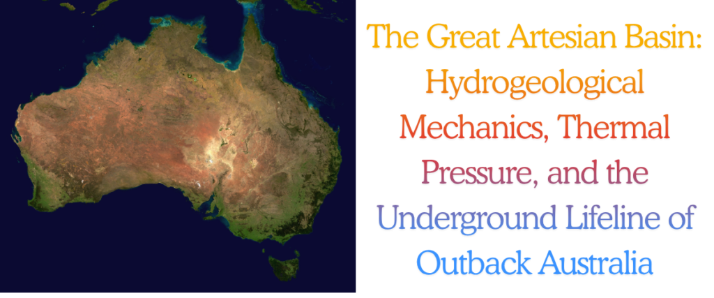
Spanning an astonishing 1.7 million square kilometres and underlying approximately one-fifth of the Australian continent, the Great Artesian Basin (GAB) represents one of the largest, deepest, and most structurally complex confined aquifer systems on the planet1. Extending beneath the arid and semi-arid landscapes of Queensland, New South Wales, South Australia, and the Northern Territory, this subterranean network holds an estimated 64,900 million megalitres of ancient groundwater1. The basin functions as an indispensable hydrological engine; without its continuous yield, the vast interior of Australia would be largely uninhabitable and devoid of the massive agricultural and resource economies that define it today.
Understanding the Great Artesian Basin requires a comprehensive, multidisciplinary examination of its geological architecture, the thermodynamics of its deep aquifers, and the increasing friction between competing environmental and industrial resources. Far from being a uniform, static reservoir of subterranean water, the GAB is a highly stratified, chronostratigraphic entity composed of interwoven sedimentary basins deposited between 250 and 65 million years ago5. The hydrodynamics governing this system dictate that meteoric water recharged along the elevated eastern margins percolates westward under immense lithostatic and hydraulic head pressure, occasionally breaching the surface through geological faults to create isolated, biologically rich mound springs6.
Today, the GAB is subjected to intense anthropogenic and industrial pressure. Extractive industries—most notably coal seam gas (CSG) production and large-scale mining operations—draw immense volumes of associated water from specific sedimentary measures, permanently altering local potentiometric surfaces and threatening the delicate pressure balances required to sustain natural spring flows5. Simultaneously, First Nations communities are increasingly asserting their sovereign rights to “cultural flows,” demanding that modern statutory frameworks recognise 60,000 years of Indigenous water management11. This report provides an exhaustive analysis of the Great Artesian Basin, evaluating its paleogeological evolution, the physics of its artesian thermodynamics, advanced isotopic dating of its ancient waters, the unique speciation of its dependent ecosystems, and the modern resource management paradigms designed to mitigate subsidence and ecological collapse.
Geological Basin Architecture
Stratigraphic Evolution and Paleogeology
The structural framework of the Great Artesian Basin is the product of continuous sediment deposition and violent tectonic shifting spanning the Triassic, Jurassic, and Cretaceous periods5. While frequently conceptualised as a singular hydrogeological entity for administrative and modelling purposes, the GAB is technically an amalgamation of several distinct, interconnected geological basins. The three primary structural depressions comprising the GAB are the northern Carpentaria Basin, the central-western Eromanga Basin, and the south-eastern Surat Basin6.
The formation of these basins commenced in the Late Triassic, approximately 201 million years ago. During this epoch, the tectonic shifting of the Earth’s crust resulted in massive geological uplift along the outer edges of what are now the Carpentaria, Eromanga, and Surat boundaries6. Moving into the Jurassic period (200 to 145 million years ago), intense climatic precipitation facilitated vast river and stream networks that rapidly eroded the slopes of these uplifted zones, delivering massive quantities of coarse sand and gravel into the subsiding basins1. As the topographic relief of the uplifted areas gradually flattened over millions of years, the fluvial energy of the depositional environment decreased. Consequently, sediment deposition shifted toward finer clays and clayey sands within expansive, low-energy floodplains and shallow lakes6.
This alternating high-energy and low-energy depositional environment established the GAB’s defining vertical sequence. Coarser, sandier sediments consolidated into highly porous sandstone formations, which now function as the primary aquifers. Conversely, the finer, clay-rich sediments lithified into impermeable mudstones and siltstones, which act as the confining aquitards6.
During the Cretaceous period (100 to 65 million years ago), the continent experienced significant tectonic down-warping, creating massive depressions in the Earth’s crust. Simultaneously, the tectonically induced growth of mid-oceanic ridges displaced global seawater, elevating sea levels by up to 250 metres6. This combination of crustal subsidence and marine transgression allowed a shallow inland sea to inundate the majority of inland Australia. This marine environment deposited enormous volumes of muddy sediments directly over the Jurassic sandstones6. Toward the termination of the Cretaceous period, tectonic uplift halted sediment deposition entirely. Subsequent regional erosion exposed the eastern edges of the permeable sandstone layers where they meet the western slopes of the Great Dividing Range. These exposed, upturned geological edges form the primary intake beds where meteoric water enters and recharges the basin today6.
Hydrostratigraphic Units
The resulting stratigraphy is a massive, multi-layered, confined aquifer system. While the nomenclature and classification of these geological units vary across the individual sub-basins, regional chronostratigraphic correlations utilised by Geoscience Australia provide a unified hydrogeological framework1.
| Hydrogeological Unit | Geologic Age | Primary Lithology | Hydrogeological Function |
| Winton-Mackunda | Late Cretaceous | Fine sandstone, siltstone | Aquifer (Shallow/Unconfined) |
| Rolling Downs Group | Early to Late Cretaceous | Marine mudstone, siltstone | Primary Regional Aquitard |
| Cadna-Owie – Hooray | Late Jurassic to Early Cretaceous | Quartzose sandstone | Primary Regional Aquifer |
| Westbourne / Birkhead | Middle to Late Jurassic | Siltstone, claystone | Regional Aquitard |
| Hutton Sandstone | Middle Jurassic | Sandstone | Aquifer |
| Evergreen / Poolowanna | Early Jurassic | Mudstone, shale | Aquitard |
| Precipice Sandstone | Early Jurassic | Coarse sandstone | Basal Aquifer |
Table 1: Generalised major hydrostratigraphic sequence of the Great Artesian Basin.
[cite: 7, 17, 18]
The Cadna-owie and Hooray sandstone sequences (and their stratigraphic equivalents) constitute the most extensive and productive aquifers within the GAB, characterised by high porosity and significant hydraulic conductivity7. Beneath this primary water-bearing zone, the Hutton and Precipice sandstones serve as critical deep aquifers, particularly within the Surat Basin, where they interact hydrodynamically with the gas-rich Walloon Coal Measures15.
Confining these immense reservoirs is the Rolling Downs Group, a massive, thick marine aquitard. The immense weight and low permeability of this mudstone layer maintain the extraordinary hydraulic pressure required to generate artesian flow across the basin’s arid interior, preventing the underlying groundwater from evaporating or escaping to the surface prematurely7.
Structural Controls and Polygonal Faulting
While aquitards such as the Rolling Downs Group are generally considered highly impermeable, regional structural elements heavily influence cross-formational fluid flow. Extensive geophysical mapping, utilising seismic data and airborne electromagnetics, has identified significant structural controls across the basin, including normal faulting and widespread polygonal faulting within the Cretaceous aquitards7.
Polygonal faulting is a unique geological phenomenon characterised by dense, multidirectional networks of small-scale displacement fractures that compromise the seal integrity of the aquitard7. Rather than acting as a perfect seal, these fault networks act as localised vertical conduits, allowing highly pressurised groundwater to leak upwards from the Cadna-owie – Hooray aquifer into shallower alluvial systems, or directly to the surface4. This vertical leakage is a fundamental component of the basin’s natural plumbing; in the basin’s primary discharge zone surrounding Lake Eyre, vertical upward leakage accounts for approximately 45% of the total natural groundwater discharge6.
Hydrodynamics and Groundwater Recharge
Recharge Zones and AEM Mapping
Recharge of the Great Artesian Basin is geographically restricted, occurring primarily along the elevated eastern margins where the Jurassic and Cretaceous sandstone aquifers outcrop against the western slopes of the Great Dividing Range in Queensland and New South Wales6. In these intake beds, intense seasonal rainfall and concentrated streamflow infiltrate the porous, exposed sandstone4.
To better delineate these critical recharge zones, Geoscience Australia has heavily utilised Airborne Electromagnetic (AEM) surveys, specifically deploying the SkyTEM system21. As part of the Exploring for the Future (EFTF) program, AEM surveys map the electrical conductivity of the subsurface across broad transects, allowing hydrogeologists to identify variations in regolith thickness and map the precise locations where permeable bedrock acts as an open conduit for meteoric water21. By measuring the conductivity of key bedrock units under cover, AEM data provide an unprecedented understanding of near-surface Neogene faults and the architecture of the intake beds19.
Despite the basin’s massive volumetric capacity, active recharge areas constitute only 10% of the total basin area6. Furthermore, environmental modelling indicates that only 1% to 2% of total rainfall over these intake beds effectively bypasses evapotranspiration to contribute to deep aquifer recharge, amounting to an average infiltration of just one million megalitres per year6.
Potentiometric Surfaces and Regional Flow
Once meteoric water enters the intake beds, gravity and the immense lithostatic pressure of the overlying confining layers drive the water westward and southward across the continent15. Because the intake beds are located at high elevations (up to 1000 metres above sea level) and the discharge zones are often near or below sea level, a massive hydraulic head is generated25.
The potentiometric surface—the hypothetical level to which groundwater would rise if unconfined by the overlying aquitard—remains far above ground level for much of the central and western basin. This hydrostatic force results in free-flowing artesian conditions; when bores are drilled through the Rolling Downs aquitard, or when natural faults are encountered, the water violently erupts to the surface without the need for mechanical pumping4.
Groundwater flow rates within the GAB are exceptionally slow, heavily constrained by the intrinsic permeability of the specific sandstone matrix. Typical flow velocities range between 1 and 5 metres per year6. Due to this sluggish hydrodynamic transit, water discharging from springs in the western extremes of South Australia may have been moving continuously through the aquifer system for over a million years28.
Hydrogeochemistry and Solute Evolution
As groundwater slowly traverses the Great Artesian Basin, its chemical composition undergoes profound evolutionary changes dictated by water-rock interactions, ion exchange, and residence time20.
Near the eastern recharge zones, the groundwater is relatively fresh and is typically characterised by a calcium-bicarbonate (Ca-HCO3) signature31. As the water flows westward through the deep confined aquifers, it undergoes continuous cation exchange. Calcium (Ca2+) and magnesium (Mg2+) ions in the water are exchanged for sodium (Na+) ions present in the clay minerals of the sandstone and interbedded aquitards30. Consequently, by the time the groundwater reaches the central and western regions of the basin, it has evolved into a highly alkaline sodium-bicarbonate-chloride (Na-HCO3-Cl) type water30.
This hydrochemical evolution has significant economic implications. The elevated sodium and bicarbonate concentrations, coupled with increasing total dissolved solids (TDS) and salinity, render the groundwater in much of the central and western GAB highly unsuitable for crop irrigation, as it destroys soil structure and induces sodicity20. However, this same water remains generally suitable for livestock consumption, making the GAB the foundational water source for the outback pastoral industry32.
Furthermore, the prolonged residence time and specific lithological interactions result in elevated concentrations of trace elements, most notably fluoride7. In specific discharge zones and older groundwater regimes, fluoride enrichment necessitates active municipal treatment before the water can be utilised for human consumption, underscoring the complexity of managing deep basin hydrogeochemistry7.
Advanced Isotopic Tracing and Deep-Time Chronology
Given the vast spatial extent and incredibly slow flow velocities of the GAB, traditional hydrogeological monitoring (such as pressure drawdowns and flow metering) is insufficient to model long-term groundwater provenance and residence times. To resolve this, researchers rely on a highly specialised suite of isotopic tracers—Carbon-14 (14C), Chlorine-36 (36Cl), Krypton-81 (81Kr), and Helium-4 (4He)—to date the groundwater and rigorously map its flow paths34.
Radiocarbon (14C) and the Pleistocene Boundary
Radiocarbon dating, relying on the decay of 14C (half-life of 5,730 years), is highly effective for analysing groundwater residence times up to approximately 30,000 to 40,000 years29. As meteoric water percolates through the soil zone in the eastern recharge beds, it dissolves 14C from biological respiration and soil CO2. In the shallow margins of the GAB, 14C activities show modern to Late Pleistocene ages, confirming active contemporary recharge37. However, once the groundwater travels deep into the confined sections of the Eromanga and Carpentaria basins, the 14C activity drops completely below analytical detection limits, necessitating the use of longer-lived radioisotopes29.
Chlorine-36 (36Cl) and Secular Equilibrium Challenges
For much of the late 20th century, Chlorine-36 (half-life of 301,000 years) served as the primary chronometer for dating very old groundwater28. Produced in the upper atmosphere by cosmic ray spallation of Argon, 36Cl enters the groundwater system via precipitation. Theoretically, the radioactive decay of the initial meteoric 36Cl/Cl ratio can be used to calculate groundwater ages as the water moves across the continent28.
However, dating GAB groundwater with 36Cl presents severe geochemical complications. Deep within the aquifer matrix, trace amounts of naturally occurring uranium and thorium emit neutrons that interact with stable 35Cl to produce nucleogenic 36Cl in situ28. Over extended geological timeframes, this subsurface production reaches a state of secular equilibrium, where the rate of radioactive decay perfectly matches the rate of nucleogenic production28. Furthermore, the subsurface dissolution of stable chloride from ancient marine aquitards artificially dilutes the 36Cl/Cl ratio, leading to highly complex and sometimes discordant age interpretations if not rigorously calibrated against independent tracers28.
Krypton-81 (81Kr) and Atom Trap Trace Analysis
To overcome the inherent limitations of 36Cl, the noble gas isotope Krypton-81 (half-life of 229,000 years) has emerged as the definitive tracer for deep, ancient groundwater dating28. Unlike chlorine, krypton is a noble gas; it does not undergo chemical reactions, it does not precipitate, and its subsurface nucleogenic production is virtually non-existent28.
Historically, 81Kr was impossible to measure due to its vanishingly low abundance. However, advancements in laser-based Atom Trap Trace Analysis (ATTA) now allow physicists to extract and literally count individual 81Kr atoms from massive, degassed field samples28. The age of the groundwater is calculated by comparing the measured isotopic ratio against modern atmospheric levels28. Pioneering applications of 81Kr dating in the GAB and analogous mega-aquifers (such as the Nubian Aquifer in the Sahara) reveal continuous groundwater flow paths with residence times extending from 40,000 years up to 1.2 million years, fundamentally validating the hydrodynamic models of ultra-slow, trans-continental groundwater flow28.
Helium-4 (4He) Accumulation and Crustal Degassing
The accumulation of Helium-4 provides profound insights into the deep crustal connectivity of the basin. As groundwater flows through the GAB, it is expected to accumulate 4He produced by the alpha decay of Uranium and Thorium directly within the aquifer minerals26. However, measured 4He concentrations in the GAB often drastically exceed the expected in-situ production rates by several orders of magnitude26.
Sophisticated geochemical modelling demonstrates that this excess helium is driven by a massive, continuous upward flux of 4He degassing from the Earth’s continental crust below the basin26. The integration of 4He flux rates with 81Kr and 36Cl chronologies reveals that the Great Artesian Basin acts as a highly effective, continental-scale trap for deep crustal and mantle-derived volatiles, with vertical faults acting as direct conduits from the basement granites into the basal sandstones37.
Artesian Thermodynamics and Geothermal Potential
Geothermal Gradients and Basal Heat Flow
The thermodynamics of the Great Artesian Basin are heavily influenced by the extreme geothermal gradients of the Australian continent. In various regions, particularly within South Australia, the thick sedimentary sequences of mudstone, siltstone, and coal act as highly efficient thermal blankets44. These impermeable layers trap the heat emanating from underlying Mesoproterozoic radiogenic granites44. Because this basal heat flow is restricted from radiating efficiently to the surface, the entrapped groundwater absorbs the thermal energy, leading to dramatically elevated temperatures at depth.
Geophysical logging indicates that groundwater temperatures at the artesian bore heads routinely range between 30°C and 100°C, while temperatures in the deepest crystalline basements underlying the basin can reach 250°C at depths of 4.5 kilometres2. The extreme potentiometric pressure combined with these high temperatures produces a massive, naturally circulating hydrothermal resource classified as a Hot Sedimentary Aquifer (HSA)45.
Low-Enthalpy Power Generation: The Birdsville Facility
The thermal pressure of the GAB has been successfully harnessed for low-enthalpy geothermal power generation, most famously at the Birdsville Geothermal Power Station in remote southwest Queensland46. Commissioned as one of the few low-temperature geothermal plants in the world, the Birdsville facility accessed groundwater at 98°C from a 1,230-metre deep artesian bore that flowed naturally at 27 litres per second2.
Because 98°C is insufficient to generate adequate steam pressure for standard mechanical turbines, the plant utilised an Organic Rankine Cycle (ORC)46. The hot artesian water flowed into a heat exchanger, where it vaporised a secondary “working fluid” (isopentane) under 4 atmospheres of pressure46. The rapidly expanding isopentane vapour drove a turbine to generate a net output of 120 kW, supplying roughly 25% of the remote town’s base-load electricity needs2. Following power generation, the artesian water was cooled in ponds and integrated into the town’s municipal drinking water supply, demonstrating a highly efficient dual-use model2. While the original Birdsville plant eventually ceased operations after two decades of service, it proved the technological viability of HSA geothermal integration in the outback47.
Direct Use and Ground Source Heat Pumps
Beyond niche electricity generation, the thermal properties of the GAB are utilised extensively for direct-use applications. Ground Source Heat Pumps (GSHP) leverage the stable year-round temperatures found a few metres beneath the surface for high-efficiency commercial heating and cooling48. Deeper direct-use applications include massive industrial processes, such as at the Midfield meatworks, which extracts 82°C groundwater for use in sterilisation circuits, allowing the facility to offset hundreds of thousands of dollars in natural gas costs annually50. Furthermore, thermal aquaculture, municipal hydronic heating systems, and advanced closed-loop systems (like those pioneered by Eavor Technologies and Strike Energy) continue to expand as operators capitalise on the basin’s extraordinary geothermal gradient32.
Groundwater Dependent Ecosystems: The Mound Springs
Spring Formation Mechanics
Where the highly pressurised groundwater of the GAB encounters structural weaknesses—such as geological faults, tectonic up-warping, or the thinning of the Cretaceous aquitards near the basin margins—it flows to the surface to form natural artesian springs6. In the arid interior, the high evaporation rates cause this mineral-rich water to precipitate calcium carbonate and other dissolved solids upon reaching the surface51. Over millennia, this precipitated travertine, combined with wind-blown aeolian sand and mud, accumulates to form distinct conical mounds, lending the phenomenon the name “mound springs”51.
These springs are generally clustered in specific geographical corridors dictated by fault lineaments. The most famous is the Lake Eyre supergroup in South Australia, which includes the Dalhousie Springs complex (protected within Witjira National Park) and the Wabma Kadarbu Mound Springs52. At Dalhousie, the combined natural discharge from over 600 individual spring vents approaches 150 litres per second, with water temperatures emerging between 38°C and 43°C51.
Endemic Biodiversity and Evolutionary Cradles
Ecologically, GAB mound springs act as evolutionary islands in a vast sea of aridity56. Because they represent the only permanent freshwater in the desert interior, they serve as critical refugia for flora and fauna that are relicts of Australia’s much wetter ancient past57. The extreme geographic isolation between spring complexes has transformed these aquatic habitats into “evolutionary highways,” driving rapid, highly localized speciation56.
The biological endemism of these springs is staggering. More than 70% of the species entirely unique to the GAB springs are hydrobiid snails, primarily from the genus Fonscochlea (e.g., F. accepta, F. zeidleri, F. aquatica)57. These micro-molluscs exhibit extreme ecological niche partitioning; some species inhabit the deep, active vents near the spring source, while others are entirely restricted to the shallow, ephemeral wetland tails58.
The springs also support unique endemic vegetation, most notably the endangered salt pipewort (Eriocaulon carsonii), a distinctive herbaceous plant with white button flowers that forms dense mats in the highly alkaline wetland tails56. Other unique flora includes the herbaceous blue devil (Eryngium fontanum) and the carnivorous bladderwort (Utricularia fenshamii)56. Furthermore, the isolated, shallow pools of the Edgbaston Reserve in Queensland provide the only known habitat in the world for the critically endangered red-finned blue-eye fish (Scaturiginichthys vermeilipinnis) and the Edgbaston goby25.
Anthropogenic Threats and Ecological Conservation
The delicate ecological balance of these mound springs is highly sensitive to fluctuations in artesian pressure56. Most spring pools are incredibly shallow, rarely exceeding 30 centimetres in depth56. When potentiometric pressure drops due to excessive agricultural or industrial bore extraction, the shallow wetland tails dry up immediately, triggering localised extinction events for species dependent on those highly specific microhabitats58.
Additional physical threats include severe trampling and water fouling by feral pigs, camels, and cattle, which can devastate the delicate spring sediment and destroy habitat56. Biological threats include the competitive displacement of endemic plants like E. carsonii by aggressive colonisers such as Phragmites australis, and the predation of endemic shrimp and fish by invasive mosquitofish56. Protective measures, including the fencing of priority wetlands and rigorous feral animal control, are ongoing, but the ultimate survival of these ecosystems dictates that basin-wide hydrostatic pressure must be maintained at all costs51.
First Nations Cultural Flows and Heritage
Songlines, Trade Routes, and The Dreaming
For more than 60,000 years, the GAB mound springs have been fundamentally intertwined with the survival, culture, and spirituality of First Nations peoples11. Because the springs provided reliable, permanent freshwater in an otherwise lethal landscape, they formed the backbone of the continent’s most significant Indigenous trade and communication routes, dictating the pathways of movement, commerce, and connection across the inhospitable interior11.
The cultural, mythological, and spiritual significance of these sites is profound. For the Arabana people, the mound springs of the Kati Thanda (Lake Eyre) region are deeply embedded in ancient creation stories54. For example, the extinct mound spring of Wabma Kadarbu (Mount Hamilton) translates literally to the “snake’s head,” playing a central role in the regional Dreaming54. At nearby Pirdali-nha (The Bubbler), the violent expulsion of artesian water—which disrupts the sediments at the bottom of the pool—is culturally recognised as the writhing of the ancestral rainbow serpent (the Ngatji)33. Similarly, the Barkandji, Ngemba, and Ngarrindjeri peoples possess deep cultural economies and ceremonial obligations tied strictly to the watercourses and wetlands nourished by the basin13.
Cultural Flows and the Pursuit of Water Justice
Historically, modern statutory water management frameworks have marginalised or entirely excluded traditional Aboriginal knowledge, treating water solely as an economic or environmental commodity while ignoring native title water rights12. In response, First Nations alliances, such as the Murray Lower–Darling River Indigenous Nations (MLDRIN) and the Northern Basin Aboriginal Nations, have successfully championed the concept of “Cultural Flows”69.
The 2010 Echuca Declaration explicitly defines cultural flows as “water entitlements that are legally and beneficially owned by the Indigenous Nations of a sufficient and adequate quantity and quality to improve the spiritual, cultural, environmental, social and economic conditions of those Indigenous Nations. This is our inherent right”69.
Emerging frameworks, including Aboriginal Waterways Assessments (AWA), are now being utilised by Traditional Owners to assess the cultural values of wetlands and rigorously quantify the specific volumetric water requirements necessary to maintain these sacred landscapes12. Recognising, quantifying, and integrating these cultural flows into statutory water allocation plans is not merely an environmental objective; it is a fundamental necessity for achieving Indigenous water justice, self-determination, and legal sovereignty over unceded resources13.
Resource Friction: Economic Output and Extractive Pressures
Macroeconomic Valuation of the Basin
The modern Australian outback relies almost entirely on the Great Artesian Basin for its economic survival. A comprehensive, independent macroeconomic assessment conducted by Frontier Economics in 2024 revealed that groundwater-dependent sectors in the GAB contribute a staggering $33.2 billion in economic output annually—nearly triple the $12.8 billion value calculated in 201670.
| Economic Sector | Estimated Annual Output (AUD) | Primary Basin Dependency |
| Conventional Oil & Gas / CSG | $13.7 Billion | Resource Extraction, Associated Water Depressurisation |
| Mining | $10.2 Billion | Mineral Processing, Dust Suppression, Dewatering |
| Livestock Production | $8.9 Billion | Hydration for 14M Beef Cattle & 11M Sheep |
| Tourism | $1.67 Billion | Outback Wellness, Dalhousie Hot Springs, Heritage Sites |
| Irrigated Agriculture | $140 Million | High-Value Cropping (where salinity permits) |
Table 2: Economic output of GAB groundwater-dependent sectors (2024 parameters).
[cite: 71, 73]
Without the GAB, the pastoral industry—which relies on artesian bores to hydrate stock across massive, arid properties—would immediately collapse. However, the geographic intersection of agriculture, massive open-cut mining, and unconventional gas extraction has resulted in severe resource friction, pitting the long-term sustainability of the basin against short-term economic windfalls.
Coal Seam Gas (CSG) Extraction in the Surat Basin
The most significant and highly scrutinised modern hydrogeological stressor on the GAB is the extraction of Coal Seam Gas (CSG), particularly within the Surat Cumulative Management Area (CMA) in Queensland10. CSG is essentially natural gas trapped within the Walloon Coal Measures, held in place by immense groundwater pressure5. To release the gas, operators must extract massive volumes of “associated water” to fundamentally depressurise the coal seams5.
According to the Office of Groundwater Impact Assessment (OGIA) in their 2025 Underground Water Impact Report (UWIR), the Surat CMA currently hosts approximately 11,000 active CSG wells, a number expected to peak at 21,000 wells by 206010. Groundwater extraction in this area is immense, totalling around 58,000 megalitres per year10. Of this total, approximately 22,000 megalitres (38%) is drawn directly from the GAB aquifers10. This massive abstraction generates substantial localised cones of depression within the potentiometric surface, creating artificial downward pressure gradients that induce cross-formational leakage from overlying agricultural aquifers (such as the Condamine Alluvium) and underlying units (like the Springbok Sandstone) into the depressurised coal measures10.
Subsidence Monitoring and Statutory Mitigation
The rapid depressurisation of subsurface formations does not just remove water; it can cause the mechanical compaction of the geological strata, manifesting at the surface as land subsidence. To monitor this structural threat, regulatory bodies utilise Interferometric Synthetic Aperture Radar (InSAR) deployed on Sentinel-1 satellites to track millimetre-scale ground motion over time10. When combined with 3D geomechanical modelling, InSAR data allows the OGIA to calibrate groundwater flow models and assess the structural integrity of the bounding aquitards10.
To mitigate long-term damage to agricultural and environmental stakeholders, strict statutory frameworks are enforced. The 2025 Surat UWIR identified 744 water bores expected to experience long-term drawdown impacts, with 77 requiring immediate, proactive “make good” agreements (e.g., bore deepening, financial compensation, or alternate water supplies) within the next three years10. Furthermore, the OGIA Spring Impact Management Strategy actively monitors 86 spring complexes and 391 individual spring vents, identifying 18 spring groups at medium or high risk of flow cessation due to CSG depressurization10. Positive mitigation engineering is also being deployed; for example, treated CSG water is actively reinjected back into the deep Precipice Sandstone (up to 4,500 megalitres per year) in an attempt to restore aquifer pressure and offset extraction deficits10.
Basin Rehabilitation: The Capping and Piping Programs
Outside of the highly regulated CSG footprint, historical agricultural practices heavily degraded the GAB for over a century. Following the discovery of artesian water in the late 19th century, pastoralists drilled thousands of bores and allowed them to flow uncontrollably into open earthen drains4. This practice was monumentally inefficient; due to the extreme heat and dry soil of the outback, evaporation and seepage losses frequently exceeded 90% before the water ever reached livestock4.
This staggering volumetric waste precipitated a basin-wide collapse in hydraulic head pressure, causing hundreds of natural mound springs to run dry and causing on-farm bores to cease flowing47. In response, joint government and industry initiatives, spearheaded by the Great Artesian Basin Sustainability Initiative (GABSI) and subsequent state programs, embarked on massive infrastructure overhauls to cap free-flowing bores and replace open earthen drains with highly efficient closed polyethylene pipe networks4.
These capping programs have successfully rehabilitated hundreds of bores and saved hundreds of thousands of megalitres of water annually. The result has been a tangible, measured recovery in potentiometric pressure across vast tracts of the basin, leading to the reactivation of previously dormant natural springs and securing the water supply for future generations53.
Conclusion
The Great Artesian Basin is an extraordinary feat of continental hydrogeology, acting as the absolute lifeblood of inland Australia. Its multi-layered architectural framework, established through violent tectonic shifts and alternating depositional environments over hundreds of millions of years, dictates a complex hydrodynamic regime. Within this system, ancient waters flow with glacial slowness across the continent, absorbing immense heat from deep crustal sources and dissolving noble gas isotopes that reveal subterranean histories stretching back over a million years. Where this highly pressurised, thermal water breaches the surface, it forms ecological sanctuaries that preserve highly endemic, evolutionary relicts and underpin the sacred cultural songlines of First Nations peoples.
However, the economic reliance on this mega-aquifer has introduced severe environmental friction. While pastoral capping programs represent a triumph of basin rehabilitation and cooperative water management, the aggressive expansion of the Coal Seam Gas sector continues to challenge the limits of sustainable abstraction, inducing subsidence and altering ancient pressure gradients. Moving forward, the preservation of the Great Artesian Basin requires the rigorous enforcement of cumulative impact assessments, the continued deployment of advanced geospatial and isotopic monitoring, and the genuine legal integration of Indigenous cultural flow frameworks. Only through a holistic, multidisciplinary approach can Australia ensure that this subterranean lifeline continues to flow, sustaining both its people and its unique ecosystems for millennia to come.
Disclaimer
This article is intended for general informational and educational purposes only and does not constitute professional scientific, hydrogeological, environmental, or legal advice. While the content is based on extensive research regarding the Great Artesian Basin (GAB)—including its geological architecture, artesian thermodynamics, and associated ecosystems—the basin is a highly complex and dynamic subterranean environment.
Please be aware of the following considerations:
- Environmental and Resource Data: Information regarding groundwater pressure, recharge rates, and the impacts of extractive industries like coal seam gas (CSG) is based on available scientific models and statutory reports, such as those from the Office of Groundwater Impact Assessment (OGIA). These baseline conditions are subject to continuous geospatial monitoring, and the data will evolve over time. This article should not be relied upon for making decisions related to land-use planning, environmental compliance, bore sinking, or agricultural water allocations.
- Economic Valuations: The macroeconomic figures presented, such as the estimated $33.2 billion annual economic output of GAB-dependent sectors, reflect specific independent assessments and are subject to market fluctuations, inflation, and changing industrial footprints.
- Cultural Heritage and Native Title: Discussions involving First Nations cultural flows, Songlines, and the deep spiritual significance of the mound springs to groups such as the Arabana people are included to provide vital historical and cultural context. However, this text does not serve as an authoritative or legal source on Native Title, Indigenous water rights, or cultural heritage management. Readers seeking guidance on these matters should consult directly with relevant Traditional Owners, Aboriginal Land Councils, and appropriate statutory bodies.
For any operational, legal, financial, or policy decisions concerning the Great Artesian Basin, readers must independently consult qualified professionals, certified hydrogeologists, and the appropriate government regulatory authorities.
References
- Revised Jurassic and Cretaceous stratigraphic correlations across, https://pesa.com.au/rollet-n-et-al-_cabs-iv-special-publication_volume-2/
- Great Artesian Basin – Wikipedia, https://en.wikipedia.org/wiki/Great_Artesian_Basin
- The Mound Springs of Arabana – The Nature Conservancy Australia, https://www.natureaustralia.org.au/what-we-do/our-priorities/land-and-freshwater/land-freshwater-stories/the-mound-springs-of-arabana/
- Hydrogeology of the Great Artesian Basin – WetlandInfo, https://wetlandinfo.detsi.qld.gov.au/wetlands/ecology/processes-systems/water/catchment-stories/gab/
- The Great Artesian Basin and CSG – GISERA, https://gisera.csiro.au/resources/frequently-asked-questions/the-great-artesian-basin-and-coal-seam-gas/
- The Australian Great Artesian Basin – ArcGIS StoryMaps, https://storymaps.arcgis.com/stories/2f12920414484556b032bec2d615fa75
- Hydrogeological atlas of the Great Artesian Basin, https://www.ga.gov.au/scientific-topics/water/groundwater/gab/hydrogeological-atlas-of-the-great-artesian-basin
- Prescriptions for Mound Springs in Far North – Enviro Data SA, https://data.environment.sa.gov.au/Content/Publications/MoundSpringsManagementPlanning-FarNorthSA_2000.pdf
- The Great Artesian Basin. – IAH Australia, https://www.iah.org.au/wp-content/uploads/2015/04/1_Great-Artesian-Basin.pdf
- Underground Water Impact Report 2025 for the Surat Cumulative, https://www.ogia.water.qld.gov.au/__data/assets/pdf_file/0017/2161061/uwir-2025-report.pdf
- Cultural Heritage in South Australia – ANTAR, https://antar.org.au/issue/cultural-heritage/cultural-heritage-in-the-states-and-territories/sa/
- Cultural flows – FIELD STUDIES FINAL REPORT, http://culturalflows.com.au/~culturalflowscom/images/documents/Final%20report.pdf
- Water colonialism and Indigenous water justice in south-eastern, https://www.tandfonline.com/doi/full/10.1080/07900627.2020.1868980
- Geological and hydrogeological architecture of the Great Artesian, https://ecat.ga.gov.au/geonetwork/srv/api/records/4a6f450e-95f0-4e4f-ae03-8126cf3d2cdc?language=eng
- 2.3.2.2.5 Great Artesian Basin aquifers – Bioregional Assessments |, https://www.bioregionalassessments.gov.au/assessments/23-conceptual-modelling-maranoa-balonne-condamine-subregion/23225-great-artesian-basin-aquifers
- Geological and hydrogeological architecture of the Great Artesian, https://ecat.ga.gov.au/geonetwork/srv/api/records/4a6f450e-95f0-4e4f-ae03-8126cf3d2cdc
- (PDF) Geological and hydrogeological architecture of the Great, https://www.researchgate.net/publication/382941755_Geological_and_hydrogeological_architecture_of_the_Great_Artesian_Basin_-_A_framework_to_develop_hydrogeological_conceptualisations
- 2.3.2.2 Geology and hydrogeology – Bioregional Assessments |, https://www.bioregionalassessments.gov.au/assessments/23-conceptual-modelling-galilee-subregion/2322-geology-and-hydrogeology
- Surat and Galilee basins – eftf.ga.gov.au – Geoscience Australia, https://www.eftf.ga.gov.au/surat-and-galilee-basins
- Hydrochemical assessment of the Hutton and Precipice sandstone, https://gisera.csiro.au/wp-content/uploads/2018/03/Water-6-Milestone-3.1-Report.pdf
- Great Artesian Basin, Queensland, Airborne Electromagnetic Survey, https://researchdata.edu.au/great-artesian-basin-survey-skytem/3440469
- Great Artesian Basin, Queensland, Airborne Electromagnetic Survey, https://ecat.ga.gov.au/geonetwork/srv/api/records/fed810c7-c59d-4bd5-8f0f-e5c4cb1745fe
- Airborne electromagnetics | Geoscience Australia, https://www.ga.gov.au/scientific-topics/disciplines/geophysics/airborne-electromagnetics
- Review: The evolving understanding of the Great Artesian Basin, https://gas-energy.centre.uq.edu.au/gab/latest-research/gab-evolving-understanding-great-artesian-basin
- Recovery plan for the community of native species dependent on, https://www.dcceew.gov.au/sites/default/files/documents/great-artesian-basin-ec.pdf
- Groundwater flow and the 4He distribution – in the Great Artesian, https://www.gwb.com/pdf/pubs/JGR1999.pdf
- One million year old groundwater in the Sahara revealed by krypton, https://www.uni-ulm.de/fileadmin/website_uni_ulm/nawi.inst.220/lehre/HauptSem_WS2007/0402092.pdf
- One million year old groundwater in the Sahara revealed by krypton, https://mathscinotes.com/wp-content/uploads/2013/12/GRL31.pdf
- Krypton-81 dating of the deep Continental Intercalaire aquifer with, https://ora.ox.ac.uk/objects/uuid:4441b2c6-025e-4254-9072-62c0db5d9ce8/files/rmg74qm09k
- Spatial distribution and influencing factors, and health risks of high, https://pmc.ncbi.nlm.nih.gov/articles/PMC12436557/
- Very Old Groundwater : Eastern Great Artesian Basin Case Study, https://www.semanticscholar.org/paper/Very-Old-Groundwater-%3A-Eastern-Great-Artesian-Basin-Torgersen/dc956354dba2f861ad271d270cdf3f04c9f41471
- Geothermal Resources of the Great Artesian Basin, Australia, https://techcommons.oit.edu/record/6814/files/11302.pdf
- Great Artesian Basin Basin-wide Condition Report 2024 – DCCEEW, https://www.dcceew.gov.au/sites/default/files/documents/gab-basin-wide-condition-report.pdf
- A multi-tracer approach to constraining artesian groundwater, https://apo.ansto.gov.au/bitstreams/59af0362-b0a7-422d-bea9-80d4750a9b51/download
- Improving groundwater sustainability and renewability using isotope, https://publications.water.nsw.gov.au/watergroupjspui/bitstream/100/3787/1/Improving%20groundwater%20sustainability%20and%20renewability%20using%20isotope%20hydrochemistry.pdf
- Use of Long-lived Radionuclides for Dating Very Old Groundwaters, https://www.iaea.org/projects/crp/f33023
- (PDF) Helium-4 characteristics of groundwaters from Central Australia, https://www.researchgate.net/publication/222891318_Helium-4_characteristics_of_groundwaters_from_Central_Australia_Comparative_chronology_with_chlorine-36_and_carbon-14_dating_techniques
- Krypton-81 dating constrains timing of deep groundwater flow, https://par.nsf.gov/servlets/purl/10347323
- A comparison of groundwater dating with >81>Kr, >36>Cl and >4, https://researchnow.flinders.edu.au/en/publications/a-comparison-of-groundwater-dating-with-sup81supkr-sup36supcl-and/
- Passive degassing of lithospheric volatiles recorded in shallow, https://pmc.ncbi.nlm.nih.gov/articles/PMC12158784/
- Helium–4 and noble gases as groundwater tracers – CSIRO people, https://people.csiro.au/-/media/People-Finder/S/A/Axel-Suckow/Fact-sheet-noble-gases.pdf
- Prodigious degassing of a billion years of accumulated radiogenic, https://website.whoi.edu/gfd/wp-content/uploads/sites/14/2018/10/nature12992_207825.pdf
- Helium accumulation in groundwater. II: A model for the, https://www.semanticscholar.org/paper/Helium-accumulation-in-groundwater.-II%3A-A-model-for-Torgersen-Ivey/06192a92392567caa3c2c465a8545b081ef00df2
- Geothermal | Energy & Mining, https://energymining.sa.gov.au/industry/energy-resources/geology-and-prospectivity/geothermal
- Geothermal | Geoscience Australia, https://www.ga.gov.au/aecr2024/geothermal
- Birdsville Geothermal Power Station Shows The Future, http://www.alternate-energy-sources.com/Birdsville-geothermal-power-station.html
- Birdsville’s 98°C Artesian Basin Water Journey From 1292m Deep, https://www.facebook.com/OutbackQueensland/videos/you-turn-on-the-tap-and-out-comes-water-that-started-its-journey-deep-beneath-th/969222022279250/
- Geothermal Energy in Australia, https://sen.asn.au/wp-content/uploads/SEN_Geothermal_NEW_28Aug23-V1.5.pdf
- Geothermal | Geoscience Australia, https://www.ga.gov.au/aecr2025/geothermal
- A review of hot sedimentary aquifer geothermal resources in Australia, https://www.tandfonline.com/doi/full/10.1080/00288306.2024.2374065
- Culture and geography: South Australia’s mound springs, https://www.aicomos.com/wp-content/uploads/Culture-and-geography-South-Australia%E2%80%99s-mound-springs-as-trade-and-communication-routes1.pdf
- Dalhousie Springs – Wikipedia, https://en.wikipedia.org/wiki/Dalhousie_Springs
- The Great Artesian Basin and Its Springs, https://www.friendsofmoundsprings.org.au/projects-and-activities/the-great-artesian-basin-and-its-springs/
- Wabma Kadarbu Mound Springs Conservation Park, https://www.parks.sa.gov.au/parks/wabma-kadarbu-mound-springs-conservation-park
- The Witjira-Dalhousie Springs, large artesian water system in South, https://adelaideaz.com/articles/witjira-dalhousie-springs-a-large-artesian-water-system-in-south-australia-s-north-of-national-and-world-significance_copy_copy
- AUSTRALIA’S ‘PERMANENT PUDDLES’ ARE VITAL ECOSYSTEMS, https://spinelessecology.wordpress.com/wp-content/uploads/2014/11/sam-nicol-et-al-article-springs-2.pdf
- Arid springs: the hidden evolutionary cradles of Outback Australia, https://www.csiro.au/en/news/All/Articles/2017/June/arid-springs-hidden-evolutionary-cradles-outback-australia
- The ecology of narrow-range endemic macro-invertebrates of Great, https://espace.library.uq.edu.au/view/UQ:715229/s4057504_final_thesis.pdf
- A comprehensive review of South Australia’s Great Artesian Basin, https://artefacts-discovery.researcher.life/full_text/DA-2/bf/bfd0631919a23845a5b2e694947395d6/full_text/32309996b19103ab33a08b3f4c5066fd.pdf
- The Conservation Biology of Molluscs – IUCN Portals, https://portals.iucn.org/library/sites/library/files/documents/ssc-op-009.pdf
- Time capsules of biodiversity: Future research directions … – Frontiers, https://www.frontiersin.org/journals/environmental-science/articles/10.3389/fenvs.2022.1021987/full
- Lake Eyre Basin Springs Assessment – Ecohydrological conceptual, https://www.waterconnect.sa.gov.au/Content/Publications/DEW/LEBSA_Ecohydrological_conceptual_models_of_springs.pdf
- A natural heritage assessment of Australia’s Great Artesian Basin, https://www.biorxiv.org/content/10.1101/2023.10.29.564639v1.full-text
- Incorporating the cultural values and perspectives of Australia’s First, https://researchsystem.canberra.edu.au/ws/portalfiles/portal/90837600/Moggridge_Bradley.pdf
- Springs and ingenious Indigenous ways of managing water form, https://adelaideaz.com/articles/springs-and-ingenious-indigenous-ways-of-managing-water-of-an-ancient-infrastructure-of-oral-knowledge
- Aboriginal People Archives | Friends of Mound Springs (FOMS), https://www.friendsofmoundsprings.org.au/projects-and-activities/tag/aboriginal-people/
- First Nations water case studies, https://www.environment.sa.gov.au/topics/water-and-river-murray/first-nations-water-interests/case-studies
- Indigenous water rights and water law reforms in Australia, https://research-repository.griffith.edu.au/server/api/core/bitstreams/00c8499c-5161-464a-8581-0ce135a5691a/content
- First Nations water policy – DCCEEW, https://www.dcceew.gov.au/water/policy/first-nations
- Great Artesian Basin: Economic output triples since 2016 assessment, https://www.frontier-economics.com.au/great-artesian-basin-economic-output-triples-since-2016-assessment/
- Review of the condition of Great Artesian Basin water … – DCCEEW, https://www.dcceew.gov.au/water/policy/national/great-artesian-basin/basin-wide-condition-report
- Economic output of groundwater dependent sectors in the Great, https://www.dcceew.gov.au/water/policy/national/great-artesian-basin/economic-output-groundwater-dependent-sectors-great-artesian-basin
- Economic output of groundwater dependent sectors in the Great, https://www.agriculture.gov.au/sites/default/files/sitecollectiondocuments/water/gab-economics-report.pdf
- The Surat CMA – Office of Groundwater Impact Assessment, https://www.ogia.water.qld.gov.au/surat-cma
- Underground Water Impact Report 2021 for the Surat Cumulative, https://www.rdmw.qld.gov.au/__data/assets/pdf_file/0005/1584725/uwir-2021-appendices.pdf
- Land Subsidence Monitoring | INSAR Corporation, https://insarcorp.com/land-subsidence-monitoring/
- InSAR for monitoring of ground motion in the Surat Basin, https://www.ogia.water.qld.gov.au/__data/assets/pdf_file/0006/1990302/insar-monitoring-ground-motion-surat-basin.pdf
- Predicting disaster before it strikes: InSAR in Australia – Spatial Source, https://www.spatialsource.com.au/predicting-disaster-strikes-insar-australia/
- Stage 1 CSG Water Monitoring and Management Plan – Arrow Energy, https://www.arrowenergy.com.au/wp-content/uploads/2025/08/SGP-Water-Monitoring-and-Management-Plan.pdf